What Thickening Clouds Can and Cannot Tell You
When a thin veil becomes a broad grey layer, or when blue gaps close during an afternoon, “the clouds are thickening” is often a good observation. It describes a visible change in coverage, opacity, texture, or

When a thin veil becomes a broad grey layer, or when blue gaps close during an afternoon, “the clouds are thickening” is often a good observation. It describes a visible change in coverage, opacity, texture, or apparent depth. The mistake begins when that observation is promoted straight into a precise prediction: “therefore it will rain here soon.” Thickening clouds can be a reason to look more carefully and check an official forecast. By themselves, they are not a reliable timetable or warning system.
That distinction is not pedantic. It makes a weather journal more useful because it preserves what you actually knew at the time.
Record the change before explaining it
“Thickening” is not one official cloud label. It is shorthand for a comparison between two observations. Make the comparison visible in the note.
Instead of writing “clouds thickening, rain coming,” try: “At 13:00, a thin white veil covered about half the sky. At 15:30, a continuous grey layer covered nearly all of it; the Sun was no longer distinct. No precipitation observed at this location.” The second version gives a later reader a time sequence, cloud amount, appearance, and an explicit limit.
The WMO cloud classification recognizes a limited set of characteristic forms, while also noting that clouds evolve continuously and can appear in transitional forms. That is one reason a changing sky should not be treated as a single-message code. You may see a change in a layer, a change in the amount of cloud, or simply a different cloud moving into view.
What the observation can support
A well-recorded thickening-cloud observation can support several modest conclusions:
- The visible sky changed between two stated times.
- Cloud coverage or transparency changed from your viewpoint.
- A cloud layer may have become more continuous, or a new layer may have arrived.
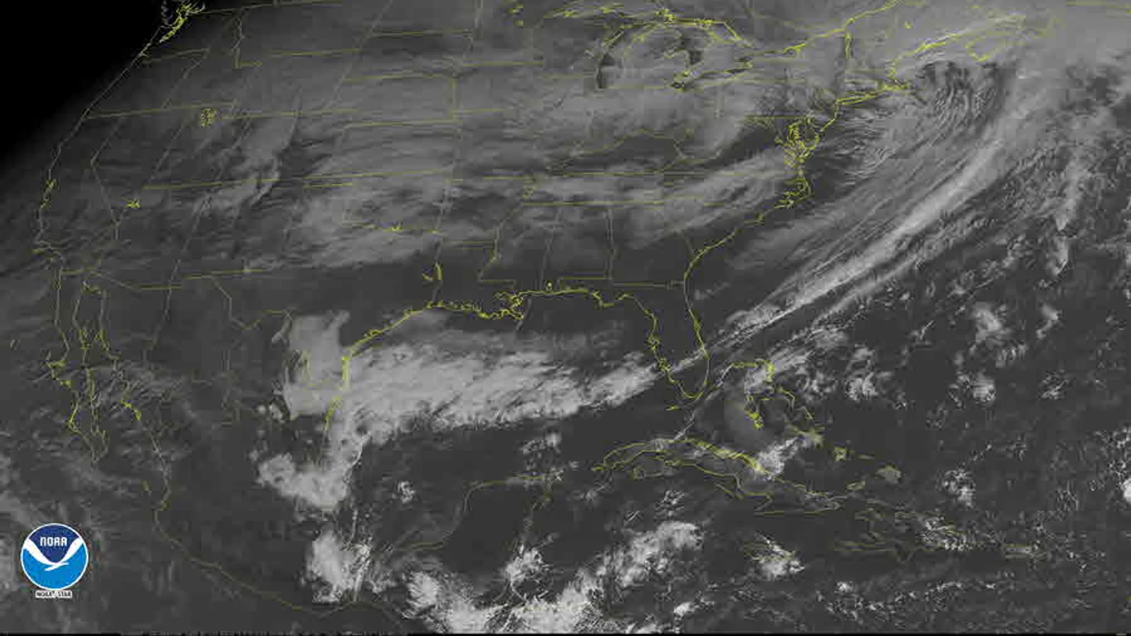
- The change is worth comparing with radar, satellite imagery, pressure charts, or a forecast if those products are relevant and current.
These are useful results. They can help you learn the rhythm of a place and improve your descriptive vocabulary. They can also make a later comparison with official data more honest. The observation does not need to be predictive to have value.
Why the shortcut to rain fails
Cloud appearance at one location does not reveal every part of the atmosphere that influences precipitation at the ground. A layer may thicken without producing rain where you stand. Rain may evaporate before reaching the ground. Another cloud layer may move in front of the first one. A local view can also be shaped by hills, buildings, haze, or a restricted horizon.
Weather forecasting deals with a much larger evidence base. The National Weather Service describes forecast analysis as using surface observations, satellite imagery, radar, upper-air data, aircraft observations and other information to understand the current atmosphere and its likely evolution. A person looking upward is making one valuable surface observation, not reproducing that entire analysis.
The strongest counterargument is real: some cloud changes often occur alongside weather systems that later bring precipitation. That is why experienced observers notice them. But “often occurs alongside” is not the same as “determines what will happen at this address and hour.” The counterargument becomes more persuasive only when it is joined by appropriate broader evidence and an official forecast.
A useful four-column boundary
Use this decision frame in your journal:
| Level | Example | What you may write |
|---|---|---|
| Observation | The layer became darker and more continuous. | “Overcast by 16:00; Sun no longer visible.” |
| Cautious interpretation | The sky changed in a way that may be relevant to a larger pattern. | “Checked the forecast after the layer thickened.” |
| Forecast | Future conditions are expected over a stated area and period. | Attribute it to the official forecast source. |
| Warning | A responsible authority identifies a hazard and action context. | Follow the authority; do not substitute a cloud note. |
The table does not prohibit curiosity. It identifies who is making which kind of claim. Your note remains at the first level unless it clearly attributes a broader product or analysis.
Work through one comparison
Imagine two entries from the same viewpoint. At 10:00 you record scattered, high-looking filaments and broad blue gaps. At 14:00 you record a grey-white sheet over most of the sky, with the Sun visible only as a bright patch. At 16:00 you note light rain. A tempting story is that the first cloud “predicted” the rain.
A better record is more restrained: the visible cloud changed between 10:00 and 14:00; rain was observed at 16:00; an official forecast or map may provide additional context, but the journal alone did not establish a causal chain. If a similar sequence appears repeatedly, it is a question worth investigating, not a personal forecasting rule.
This approach also handles an equally important result: no rain arrives. “Layer thickened from 14:00 to 17:00; no precipitation observed by 21:00” is not a failed observation. It is evidence against an overconfident shortcut.
It also helps to distinguish a change in your view from a change across the whole sky. A building can hide the lower part of a cloud deck; trees can make a horizon seem darker; a moving gap can pass beyond a narrow window view. If possible, note the direction in which coverage increased and whether your view was open. If it was not, state that plainly. “Cloud coverage increased in the visible western sector; eastern horizon blocked by buildings” is more informative than an unqualified claim that the entire sky changed.
Let the limit improve the record
The practical conclusion is simple. When clouds thicken, record what changed, when it changed, and what was or was not observed at the ground. Then consult the official forecast if you need to make a plan, and official warnings if safety is involved.
The conclusion would need revising if authoritative operational guidance established that one isolated visual change reliably determines a specific outcome. That is not how public forecasting is presented: forecasting combines many observations and analysis. For a citizen observer, the disciplined boundary is therefore a strength, not a missing skill.